
The video begins at 3:49.
PRESENTATION ARCHIVE
OVERVIEW
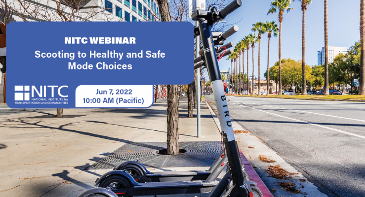
Shared electric scooters (e-scooters) are fast becoming a mobility option in cities across the United States. This new micromobility mode has the potential to replace car usage for certain trips, which stands to have a positive impact on public health and sustainability goals. However, many aspects of this emerging mode are not well understood.This webinar explores the findings of three NITC studies examining transportation mode choices, safety, and public health outcomes of electric scooters.
KEY LEARNING OUTCOMES
By the end of this presentation, the participant will be able to:
- describe the ways in which electric scooters may provide new substitutive, complimentary or synergist transportation opportunities for different activities...
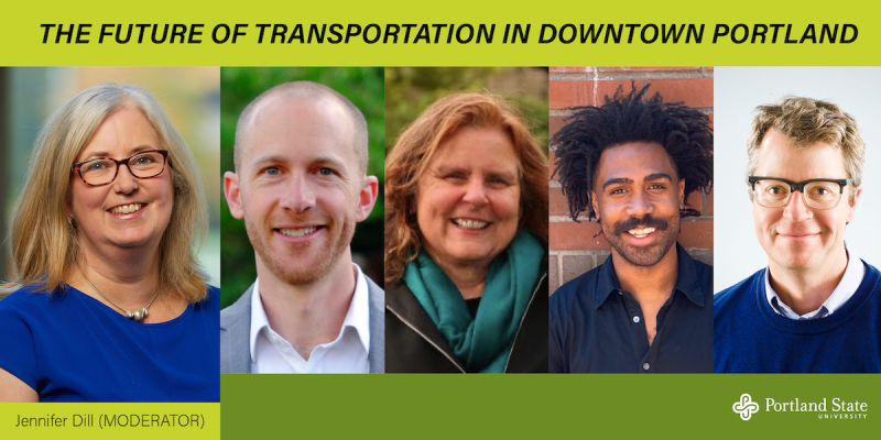
Join us Monday, October 24, as TREC director Jennifer Dill moderates a panel on the Future of Transportation in Downtown Portland. Register to attend in person (space is limited), or join online via Zoom.
Moderator: Jennifer Dill, Professor, Toulan School of Urban Studies & Planning and Director of PSU’s Transportation Research and Education Center (TREC)
Panelists:
Gabriel Graff, Central City Capital Program Manager, Portland Bureau of Transportation
Cathy Tuttle, Board Member, BikeLoud PDX
André Lightsey-Walker, Policy Transformation Manager, The Street Trust
Mark Raggett, Associate Principal, GBD Architects and Director of Planning and Design, Friends of Green Loop
The year 2022 marked the 50th anniversary of the City of Portland's 1972 Downtown Plan, one of the most consequential plans in the city's history. It put in place a vision for a public, pedestrian-scaled, multipurpose, and vital downtown. Through the requirements adopted in the Downtown Plan and subsequent...
Read moreThe video begins at 1:47.
Joseph Broach, PhD candidate in Urban Studies, will discuss the results of his research, which models the propensity of children aged 6-16 to walk or bike to parks and school without an adult chaperone, extending existing work on children’s active travel in several ways: 1) focus on travel without an adult, 2) inclusion of school and a non-school destinations, 3) separate walk and bike models, 4) consideration of both parent and child attitudes and perceived social norms, 5) explicit inclusion of household rules limiting walking or bicycling.
The proliferation of information technology in the transportation field has opened up opportunities for communication and analysis of the performance of transportation facilities. The Highway Capacity Manual relies on rules of thumb and small data samples to generate levels of service to assess performance, but modern detection technology gives us the opportunity to better capture the dynamism of these systems and examine their performance from many perspectives. Travelers, operations staff, and researchers can benefit from measurements that provide information such as travel time, effectiveness of signal coordination, and traffic density. In particular, inductive loop detectors show promise as a tool to collect the data necessary to generate such information. But while their use for this purpose on restricted‐access facilities is well understood, a great many challenges remain in using loop detectors to measure the performance of surface streets.
This thesis proposes 6 methods for estimating arterial travel time. Estimates are compared to simulated data visually, with input/output diagrams; and statistically, with travel times. Methods for estimating travel time are applied to aggregated data and to varying detector densities and evaluated as above. Conclusions are drawn about which method provides the best estimates, what levels of data aggregation can still provide useful information, and what the effects of detector density are on the quality of estimates....
Read more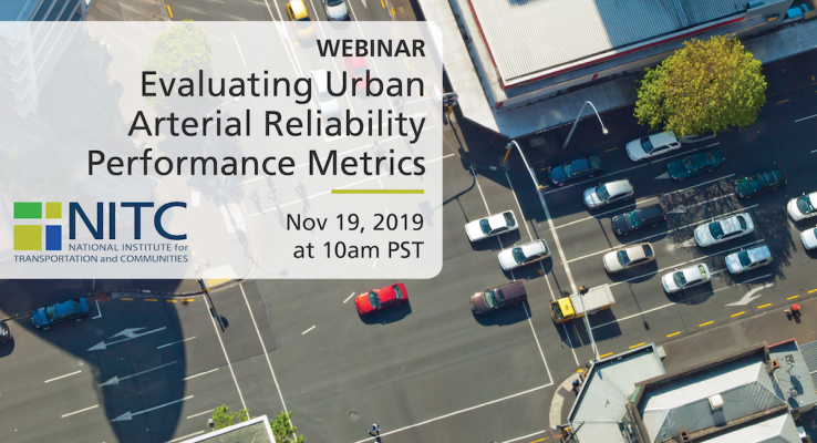
PRESENTATION ARCHIVE
Miss the webinar or want a look back?
OVERVIEW
With worsening congestion, travel time reliability is increasingly becoming as critical as average travel times in affecting travel choices. Researchers from Portland State University (PSU) partnered with Washington County, Oregon to offer data-driven strategies in prioritizing funding for travel time reliability improvements on their urban arterials. The vast majority of existing research on travel time reliability has focused exclusively on freeways. Avinash Unnikrishnan, Sirisha Kothuri and Jason C. Anderson leveraged Bluetooth sensors provided and deployed by Bluemac Analytics to identify problem areas in the county. Set up at intersections throughout Washington County, the sensors are able to calculate travel time from one intersection to another by matching Bluetooth signals from devices in people's cars. The researchers evaluated the Bluetooth travel time data to understand the temporal variation in travel time reliability metrics on these urban arterials, including factors related to time of day, weather, and holidays....
Read more
In honor of our 10-year anniversary, we’re trying something a little different. Instead of brief sessions that introduce you to a topic– we will be offering fifteen half-day workshops that focus on skill building and providing the tools to apply the latest research to practice. These will be hands-on, immersive learning experiences in a small classroom setting.
REGISTRATION
This event is a la carte, and pricing is per workshop. You may attend as few as one, or as many as four workshops.
- Half-Day Workshop (general admission): $95
- Half-Day Workshop (student rate): $50
THE PROGRAM
⇨SEE THE FULL SCHEDULE AND DETAILS
- Survey Design: Asking the Right Questions
- Bicycle/Pedestrian Focused Signal Timing Strategies: What, When, Where, Why, and How?
- Activating Community Opportunities Using Transportation Organizations as Assets
- Cost Accounting for Program and Budget Planning Today and Tomorrow
- Data Analysis for Smarties Who Forgot What They Learned in College
- What’s New in the HCM 6th Edition?
- Ecological Momentary Assessment Methods with Transportation Disadvantaged Populations
- Calculating...
The video begins at 0:48.
View slides
Speaker: Darwin Moosavi, MURP, Portland State University
Topic: Capturing the Ride: Exploring Low-Density Flexible Transit Alternatives in Salem-Keizer
Summary: Current fixed-route transit service provided by Salem-Keizer Transit is inefficient in the low-density neighborhoods of West Salem, South Salem, and Keizer. The lack of sidewalks, non-gridded circuitous streets, and large single-family residential lots all contribute to a lack of ridership. As a result, traditional fixed-route transit service is not cost-effective in these areas. Through a five month planning process, a group of Portland State University graduate students, better known as Paradigm Planning, tackled the task of addressing this problem in each of the three study areas. Paradigm’s planning process explored mode and route options in order to produce a plan that provides innovative and feasible alternatives to current transit service that will better meet the needs of the community. Through an intensive community engagement process, the residents in each neighborhood were given a voice in shaping the future of transit in their neighborhood.
Bio: Darwin Moosavi is a Master in Urban & Regional Planning candidate at Portland State University and Project...
Read more