
The video begins at 2:05.
The video begins at 0:39.
View slides
Summary: This presentation is a showcase of various GIS tools developed for bicycle network analysis and planning. The showcase includes a tool for assessing community-wide bikeability, a tool for forecasting bicycle volumes based on street topology, and a tool for evaluating different bicycle improvement plans in terms of exposure to danger situations for bicyclists. The tools will be demonstrated with case study data. The presentation will include a review of the Highway Capacity Manual Bicycle Level of Service and a discussion about using bicycle and pedestrian data collected through citizen-volunteer count programs.
Bio: Dr. Michael Lowry holds a joint appointment in Civil Engineering and Bioregional Planning at the University of Idaho. He is an affiliate researcher for the National Institute for Advanced Transportation Technology. His research focuses on capital investment decision-making and transportation planning for bicyclists and pedestrians. Dr. Lowry teaches courses related to sustainable transportation, engineering statistics, and economic analysis. He received his PhD in Civil and Environmental Engineering from the University of Washington and BS and MS from Brigham Young University.
The video begins at 1:39.
View slides
Ronald Tamse is a traffic engineer for the city of Utrecht, The Netherlands. Ronald has been involved in traffic design in Amsterdam and Utrecht. He is most interested in bicycle and rail transportation. He has worked on the design of the Amsterdam subway, a light rail system in Utrecht, and is currently working on urban transportation solutions as Utrecht Centraal is redeveloped. Utrecht Centraal is the largest train station in The Netherlands.
Ronald will highlight key examples from Utrecht that show some new ideas, similarities between the Dutch and American approaches, as well as a few lessons imported from Portland. These examples will share highlights from major projects that include building a new commuter railway network, including the rebuilding of Utrecht Centraal railway station, and the development of a light rail line in Utrecht that uses MAX as a development model. In addition, Ronald will demonstrate the importance of connecting bike infrastructure through network planning, infrastructure, and connections to transit.
The video begins at 0:32.
Copenhagen is world-renowned as a bicycle-friendly city. Since the 1980s, Copenhagen has been encouraging people to bicycle through an ambitious program that includes expanding the city’s bicycle network, building new cycle routes, and improving safety and security. Niels Jensen will highlight how the city has achieved high levels bicycling through its policies, actions and funding. Jensen has been actively involved in Copenhagen’s cycling renaissance for the past couple of decades. He has published articles and made presentations on topics such as cycle tracks, bicycle parking, and green wave corridors.
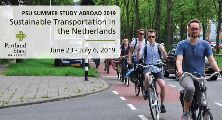
Offered through the Initiative for Bicycle and Pedestrian Innovation at TREC, this four-credit PSU study abroad program (CE 495 / 595) presents an introduction to sustainable transportation and land use applications in the Dutch context.
WATCH A RECORDED INFO SESSION
Before you apply for the program, check out some frequently asked questions or watch the recent Jan 11, 2019 information session:
PROGRAM OVERVIEW (June 23 - July 6, 2019)
The course creates an immersive experience to explore the Dutch approach to cycling, transit, innovative mobility and land use. The curriculum...
Read more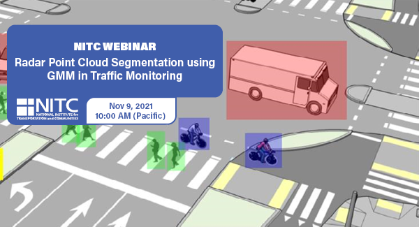
PRESENTATION ARCHIVE
OVERVIEW
Intelligent transportation systems (ITS) change our communities by improving the safety and convenience of people’s daily mobility. The system relies on multimodal traffic monitoring, that needs to provide reliable, efficient and detailed traffic information for traffic safety and planning. How to reliably and intelligently monitor intersection traffic with multimodal information is one of the most critical topics in intelligent transportation research.
In multimodal traffic monitoring, we gather traffic statistics for distinct transportation modes, such as pedestrians, cars and bicycles, in order to analyze and improve people’s daily mobility in terms of safety and convenience.
In this study, we use a high-resolution millimeter-wave (mmWave) radar sensor to obtain a relatively richer radar point cloud representation for a traffic monitoring scenario. Based on a new...
Read more