The video begins at 1:39.

View slides

Ronald Tamse is a traffic engineer for the city of Utrecht, The Netherlands. Ronald has been involved in traffic design in Amsterdam and Utrecht. He is most interested in bicycle and rail transportation. He has worked on the design of the Amsterdam subway, a light rail system in Utrecht, and is currently working on urban transportation solutions as Utrecht Centraal is redeveloped. Utrecht Centraal is the largest train station in The Netherlands.

Ronald will highlight key examples from Utrecht that show some new ideas, similarities between the Dutch and American approaches, as well as a few lessons imported from Portland. These examples will share highlights from major projects that include building a new commuter railway network, including the rebuilding of Utrecht Centraal railway station, and the development of a light rail line in Utrecht that uses MAX as a development model. In addition, Ronald will demonstrate the importance of connecting bike infrastructure through network planning, infrastructure, and connections to transit.

Watch video

View slides

Transit signal priority (TSP) is designed to reduce delay for transit vehicles through signalized intersections. For an existing TSP system, it is important to assess how timely and effective TSP phases are granted to buses that request priority. It is also necessary to evaluate the time savings and delays for buses and other vehicles as a result of TSP phases. However, due to the lack of disaggregated and integrated transit, traffic and signal phase data, previous studies have not investigated the TSP performance at the phase level. This study collects and integrates three archived databases: bus automatic vehicle location (AVL) and automatic passenger count (APC) data, intersection signal phase log data, and vehicle count data. Based on the integrated database, this research proposes innovative and useful performance measures to assess the timeliness and effectiveness of TSP phases to buses that request priority. This study also evaluates the time savings and delays to buses and other vehicles on major and minor streets. Results show that TSP performance varies significantly across intersections. On average, most of the TSP phases were granted timely to buses that request priority, but only a few of them were effective. Early green phases are more...

Read more
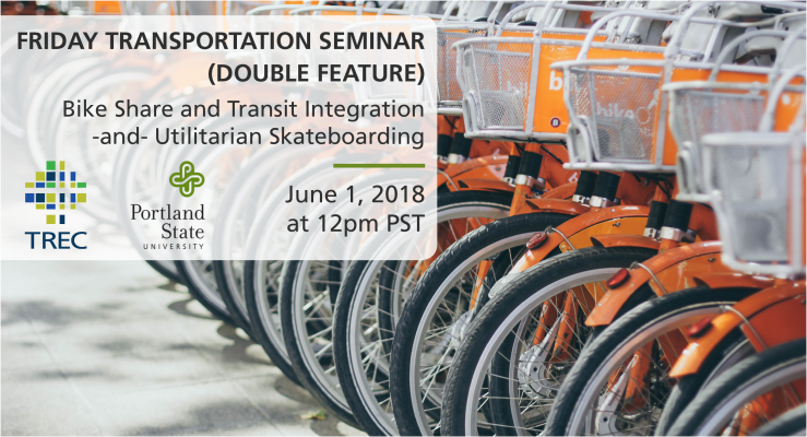
Friday Transportation Seminar at Portland State University - June 1, 2018

Friday Transportation Seminars at Portland State University have been a tradition since 2000. With over 450 seminars presented and recorded (access the archive of seminars here), we host both visiting and local scholars to share the latest in research, technology, and implementation in transportation.

EDUCATION LIBRARY ARCHIVE

Missed the seminar or want a look back? 


David Soto Padín
Graduate Research Assistant at Portland State University, and President of the Students in Transportation Engineering & Planning (ITE-STEP

David...

Read more

The video begins at 0:48.

View slides

Speaker: Darwin Moosavi, MURP, Portland State University
Topic: Capturing the Ride: Exploring Low-Density Flexible Transit Alternatives in Salem-Keizer

Summary: Current fixed-route transit service provided by Salem-Keizer Transit is inefficient in the low-density neighborhoods of West Salem, South Salem, and Keizer. The lack of sidewalks, non-gridded circuitous streets, and large single-family residential lots all contribute to a lack of ridership. As a result, traditional fixed-route transit service is not cost-effective in these areas. Through a five month planning process, a group of Portland State University graduate students, better known as Paradigm Planning, tackled the task of addressing this problem in each of the three study areas. Paradigm’s planning process explored mode and route options in order to produce a plan that provides innovative and feasible alternatives to current transit service that will better meet the needs of the community. Through an intensive community engagement process, the residents in each neighborhood were given a voice in shaping the future of transit in their neighborhood.

Bio: Darwin Moosavi is a Master in Urban & Regional Planning candidate at Portland State University and Project...

Read more

The video begins at 2:15.

Abstract: If a two-dimensional picture is worth a 1,000 words, how much more can 3D imagery convey? As part of its recently completed Strategic Plan, Metro’s TOD Program in Portland, OR has developed a new GIS -based transit orientation tool to analyze and compare the readiness of its station areas and corridors for higher density mixed-use development.  For the purposes of better capturing a more holistic view of the built environment, this innovative measure expands on the 3 “D’s” of density, diversity, and design by adopting the 5 “P’s” of people, places, physical form, performance and pedestrian/bicycle connectivity. Given the program’s interest in catalyzing near-term private development, it goes further to incorporate a strong “market strength” component. In addition to describing the tool and its future implementation, the presentation will demonstrate how the TOD Program developed and used two- and three-dimensional maps and graphics to help convey the complex methodology and findings to a broad audience of policy makers and stakeholders.

Chris is a Senior TOD Project Manager with Metro’s TOD Program in Portland, OR. Along with managing public-private development projects near transit, he led the recently completed TOD Strategic Plan and is participating in corridor planning region-wide. Prior to Metro, Chris specialized in TOD in the public and private sectors.

WATCH THE RECORDED VIDEO

 
PRESENTATION SLIDES

Miss the presentation or want a look back? You can view the presentation slides here.

OVERVIEW

Every day transit riders ask the same question: when’s the next one coming? To answer this question, transit agencies are transitioning to providing real-time transit information through smartphones or displayed at transit stops. 

The proliferation of transit planning and real time arrival tools that have hit the market over the past decade is staggering. Yet with transit ridership on the decline, agencies can’t afford to ignore the importance of providing accurate, real time information to their customers. Real-time transit information improves the reliability and efficiency of passenger travel, but barriers have prevented some transit agencies from adopting the GTFSrealtime v1.0 technology. A new NITC-funded study in May led by Sean Barbeau of the University of South Florida seeks to...

Read more

Watch video

View slides

Summary: The transportation system is the backbone of the United States' economy, and transportation is an essential part of everyday life for American citizens. It is essential that the transportation system continue to provide accessibility and connectivity to an ever-evolving global economy. A key way to do so is to embrace, develop and implement new technologies. One of the newest and most promising facets of transportation-related technology is in the field of connected mobility. The vision behind connected mobility is of a transportation system where vehicles, travelers, and infrastructure are all wirelessly connected with one another and able to transmit real-time data about things like weather, location, and vehicle and infrastructure status. Such a degree of connectivity could have substantial benefits for the safety, mobility, and sustainability of the domestic transportation system, including accident prevention and congestion reduction. In recent years, major strides have been made into the research and development of connected mobility technology and some field-testing has commenced, but there is a need for more attention and investment from stakeholders throughout the transportation community and beyond. 

Bio: Robert Bertini is a...

Read more

Pages